Comprehensive
Geospatial Solutions &
Integrated Water Resources
Welcome to edreesy, your premier destination for cutting-edge geospatial solutions. We are a leading company dedicated to harnessing the power of location intelligence and advanced mapping technologies to transform the way you perceive and interact with the world around you.
Welcome to edreesy!
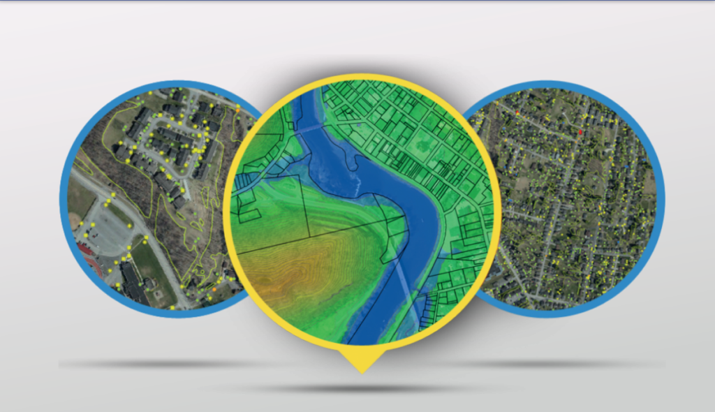
• edreesy offers geospatial services (mapping, data analysis) to help clients understand and utilize location data. • They use advanced techniques to extract insights and optimize resources (e.g., supply chain). • edreesy also helps with disaster management and urban planning through risk assessment and spatial modeling. • Overall, edreesy empowers organizations to make data-driven decisions and navigate complex situations.
Dr. Salah is an international water resources engineering and geospatial tools expert with 30 years of experience in advanced water resources modeling, engineering, integrated management, water quality, GIS, Remote Sensing (RS), asset management and data analytics. He is an energetic team player with strong leadership, communication, organizational and interpersonal skills.
He effectively establishes and manages projects in the different life cycles from planning, design, construction management to operation & maintenance. He has developed several award-winning tools and applications for advanced modeling in water, environmental, energy and transportation fields. Additional capacities include asset management, modelling integration with GIS and CAD, statistics, decision support system, computer programming and custom desktop, web and mobile GIS applications. With his education and expertise, he has managed vast set of projects from small scale applications to large multi-disciplinary projects.
Dr. Salah brings value to your project team by effective utilization of the science of data, the art of graphics to understand the complex nature of issues the project has, assemble the right resources and tools and disseminate information to provide for reliable decision making.
Walid W. Sabbah Hydrogeology Expert/Groundwater Modeling Expert
Amy Dasilva GIS Admin Asist
Dr. Ihab Imam Ragab Commercial Director / Operations Advisor
Why edreesy?
WHAT MAKES US UNIQUE
Subject matter experts and award-winning team
Customized solution for every project
State-of-the-art geospatial services
Time and resources saving tools
Advanced Artificial Intelligence & Internet of Things
Effective and efficient use of GIS and remote sensing
You have a choice
When it comes to selecting a geospatial company, there are several compelling reasons why you should choose edreesy. Our commitment to quality, timeliness, and attention to detail sets us apart, ensuring that our clients receive tailored solutions that exceed their expectations. Moreover, our company is dedicated to staying at the forefront of industry advancements, continually updating our skills and technologies to provide the most relevant and effective geospatial solutions. By choosing our geospatial company, you can be confident that you are partnering with a trusted and reliable provider that will deliver exceptional results for your spatial analysis and mapping requirements.
Who Are We
edreesy Geospatial Solutions is a well-balanced team of world experts in their respective specialties supported by midlevel professionals and junior innovators and data analysts. We strike the balance needed for the cutting edge technology integration into water resources, transportation, asset management, Internet of Things (IoT) and Artificial Intelligence (AI). We are not just a “GIS firm”, we uniquely bridge the gap between the disciplines and geospatial solutions.
We strive to push the boundaries of geospatial innovation, leveraging cutting-edge technologies to provide our clients with the most accurate and up-to-date information. Through our expertise in data analysis and interpretation, we enable businesses to extract meaningful insights from complex geospatial datasets, driving informed decision-making and strategic planning.
Furthermore, we recognize the significance of time and money in today’s fast-paced world. Our solutions are designed to help businesses save both. By automating tasks, reducing manual effort, and providing real-time information, we enable our clients to make informed decisions swiftly, resulting in significant cost savings and improved productivity.
Through our mission, we are committed to transforming the way organizations utilize geospatial data. By harnessing the power of state-of-the-art technology, AI, IoT, efficient analysis, and resource optimization, we empower businesses to unlock their true potential, achieve their goals, and stay ahead in a rapidly evolving landscape.
Mission and Philosophy
Value Proposition
At its core, our mission at edreesy is to empower organizations with state-of-the-art technology, efficient analysis, and resource optimization to save valuable time and money. Our philosophy is to master-plan implementation of technology via bi-directional integrations of world-best tools to make decisions based on reliable infromation
Subject matter experts in water, environment and transportation
Bridging the gap between subject matter and geospatial tools
Integrating IoT, sensors into master geodatabase
Smart cities/campuses experts
Geostatistical analysis and stochastic modeling
Grant writing professionals
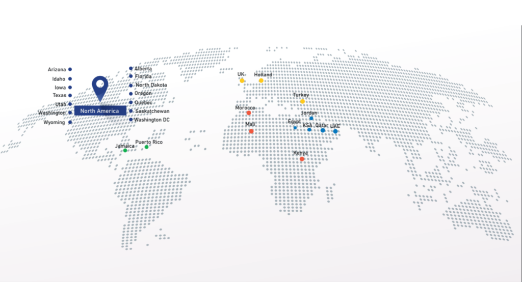
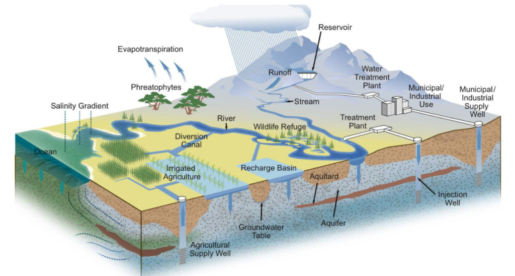
We take our global experience locally too. We can provide local topographic and hydrographic surveys in the Middle East as well as North America. We can also provide 3-D indoor-scanning, including data acquisition, post-processing, data and attribute extraction.